| Lake Sarah Outlet Restoration project
|
Lake Sarah Wier surveyed
In response to inquiries over the summer of 2018 regarding the runout level of the cablecrete mat located at the Sarah creek outlet, LSIA asked Three Rivers Park staff to do a cross section elevation survey of the wier. The results could then be used to compare to the original as-built survey in an effort to determine if the runout control had changed or settled since it's installation.
The survey accessible via the link below compares very closely to the original as-built cross section survey. Thank you to Three Rivers Park and to Amy Timm, Water Resources Supervisor - Three Rivers Park District.
|
Outlet cleanout channel dredged by City of Greenfield
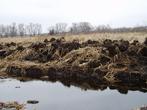
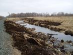
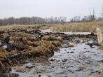
In December 2017 Public works staff from the city of Greenfield cleared the channel lakeward of the old RR weir west to TRP property and deposited the spoils in an area designated by TRP until they can be hauled to a upland disposal site. The project will make it much easier during times of high water to direct loose bogs to a safe holding area thus keeping Sarah Creek flowing at peak when we need it most. Scott Walsh and the Lake assn along with Greenfield plan on getting a permit to chemically treat the adjacent cattail areas of the channel and creek to maintain a 15 foot wide channel as we have done in the past. By doing so we will have taken our best efforts to ensure we have done our best to reduce flooding, times of "no wake" and erosion and phosphorus releases. Thank you to Scott Walsh, Three Rivers Park District, and the City of Greenfield for their continued willingness to help us maintain our outlet channel!
photos courtesy of Scott Walsh
|
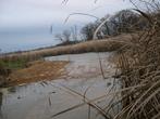
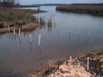
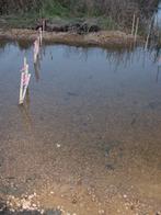
Outlet project update 04/19/2008 - In response to inquiries regarding the condition of the lake Sarah outlet channel, Mike Peterson, Fred Lang, and Brad Spencer walked the runout from county Rd 92 to the outlet (old RR weir) on April 19, 2008. The photos below show various points of interest. For reference, the visit took place 3 days before ice out, water level estimated by Mike and Brad to be at about 979.80. The runouot, CP rail culvert, creek channel, and Culvert under county rd 92 were all found to be flowing well and completely unobstructed. The outlet channe north and south of the CP rail culvert which was restored in February/March 2005 has regrown to a more natural look but remains largely clear of vegetation and is flowing well. Photos below can be viewed at full size by clicking on the thumbnails.
|
 |
| Cable-crete mat installed at runout |
|
 |
| Cable-crete mat installed at runout |
|
 |
| Cable-crete mat installed at runout |
|
 |
| site prep prior to installation of cable-crete |
|
 |
| site prep prior to installation of cable-crete |
|
 |
| Alternative 4 |
|
|
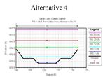
Outlet Project Update 11/10/04 - The project to stabilize the Lake Sarah runout using a cable-crete mat has been completed as of this afternoon. Photos of the project can be viewed by clicking on the thumbnail images above. Thank you to the city of Greenfield, MN DNR Waters, Three Rivers Parks District, Pioneer-Sarah Creek Watershed District, and Doboszenski & Sons for their help in completeing this project. Outlet Project Update 10/27/04 - The Cable-Concrete runout stabilization project is scheduled to be completed in early November 2004. The Greenfield City Council at its 9/21/04 meeting voted to proceed with a plan to stabilize the water run-out level of lake Sarah by installation of a concrete mat at the run-out (old weir). The shape of the runout is to be as recommended by the DNR and the lowest level is to be 978.6' - 978.8' above sea level, within the range as specified on the DNR permit. The project will cost an estimated $12,500 and has been contracted to Doboszenski & Sons. The end result of the modification is expected to raise the Ordinary High Water Level, (currently 979.9') by approximately 0.10'. Outlet Project Update 9/22/04 - Reports indicate the Greenfield City Council at its 9/21/04 meeting voted to proceed with the plan to stabilize the water run-out level of lake Sarah by installation of a concrete mat at the run-out (old weir). The shape of the runout is to be as recommended by the DNR and the lowest level is to be 978.6' - 978.8' above sea level, within the range as specified on the DNR permit. The project will be contracted to Doboszenski & Sons at an estimated cost of $12,500 and is likely to be completed this fall. The end result of the modification is expected to raise the Ordinary High Water Level, (currently 979.9') by approximately 0.10'. Outlet Project Update 9/8/04 - The Independence City Council at its 9/7/04 meeting approved a resolution to support and encourage the City of Greenfield in its effort to stabilize the water run-out level of lake Sarah and concur with the DNR’s recommendation regarding the design and placement of the structure as described as Alternative IV (see Tom Hoveys design above). This design creates a runout level with a 6 foot wide bottom set at 978.8’ above sea level. The upper level would be set at 979.20.
|
Tom Hovey, Area Hydrologist, MN DNR Waters, held an informational meeting regarding the outlet of Lake Sarah on August 26, 2004. Click on this link to download the Powerpoint slideshow used in his presentation. The purpose of the meeting was to bring everyone up to date on the permit process for the proposed cabled concrete erosion control mat at the outlet and gave people a chance to ask questions. The meeting was held at the Independence City Hall.
DNR Waters has issued a new informational brochure regarding Lake Outlet Dams in Adobe Acrobat (.pdf) format. Much of the information contained would be applicable to our current situation. (Brad 8/16/04)
Update - July 23, 2004 - In response to lake resident complaints regarding erosion at the lake Sarah runout (old RR weir), the City of Greenfield has requested MN DNR approval under the existing outlet restoration permit No. 2004-3025 for placement of a "Cable Concrete" surface on the lake Sarah outlet. The low point of the "Cable Concrete" would be at an elevation established by the MN DNR. More information on the "Cable Concrete" Block Mat System can be found on this link.
As of the 5/12/04 LSIA Board meeting, the ad hoc LSIA Lake Level committee has been dissolved. The board felt the status of the Water Level / Outlet Restoration project in its present form is, for the time being, completed and should the problem of flood stage water levels resurface, the committee may be reconstituted at that time. The committee members and remaining responsibilities of the committee have been folded into the Safety and Navigation committee under the direction of Steve Riley, Director of Safety & Navigation. The LSIA Executives and Directors wish to express their thanks and appreciation for the time and efforts of the Lake Level committee members who have worked tirelessly over the past few years to address the high water problem on our lake.
Photo collection of the Lake Sarah Outlet (old Weir) through history. Anyone who has old outlet pictures to add to our collection can email them to this site or mail them to Brad Spencer, 4510 Shady Beach Circle, Independence, MN 55359.
Click on each thumbnail image below to view photos full size with description and credits.
|
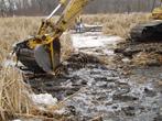
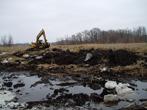
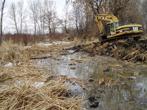
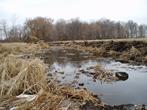
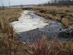
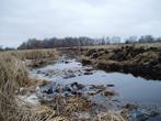
Tom Hovey - DNR Waters Area Hydrologist has updated his previous position on the weir (runout) tampering issue. In a 4/27/04 email to the LSIA board Tom writes "I typically don't comment unless asked, but I was asked by 3 individuals to comment on one aspect of a recent memo from the LSIA Board. The item of concern was a statement I made at one time about tampering of the wier being evident. We all know more now than when I made that comment. While I agree that the runout elevation has increased over the years, and I still think that the runout should be lowered according to our report, I cannot now say that effective tampering is evident. According to old photos, rocks have been there for many years. I'm sure there have been attempts over the years to block the outlet, with boards, and rock rearrangement. I have been at the outlet several times now this spring, and the material making up the weir seems to be mostly gravel, sand and silt. While it is certainly possible that the outlet is higher artificially, it is also possible that it has changed in elevation due to natural causes and lack of maintenance." (4/28/04) The Lake Sarah Outlet has been cleared of the Rock pile but remains unaltered in elevation. Tom Hovey - MNDNR Area Hydrologist and Jim Kujawa of the Pioneer Sarah Creek Watershed Management Organization surveyed the runout / weir earlier this week. Their survey information is presented on the drawing done last fall by the DNR Waters survey crew, for comparison. Conditions at the old railroad grade are very similar to conditions found last fall, with the exception of the rock pile that was removed. Most of the differences shown are the results of rod placement. Water was moving freely, and dropped about half a foot (0.54') from the upstream side of the weir to the downstream side. (3/26/03) Pictures of the Outlet Dredging project courtesy of and taken by Tim Hanson are below. Click on thumbnail images to view photos in larger size. Captions added by Brad Spencer based upon visual cues in photos, any errors can be emailed to me. Thanks to Tim Hanson and Steve Riley for providing these images! (Brad 3/8/04)
|
 |
| Dredging in progress |
|
 |
| Dredging in progress |
|
 |
| Dredging in progress |
|
 |
| Dredging in progress |
|
 |
| Dredging in progress |
|
 |
| Dredging in progress |
|
 |
| Rocks on weir |
|
 |
| Rocks on weir |
|
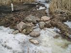 |
| Rocks on weir |
|
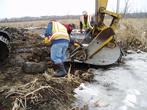 |
| Removing Rocks from weir |
|
|
 |
| Weir |
|
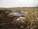 |
| Weir |
|
 |
| CP rail Culvert |
|
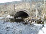 |
| CP rail culvert |
|
 |
| CP rail culvert |
|
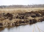 |
| Sidecast material |
|
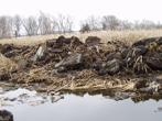 |
| Sidecast material |
|
 |
| Sidecast material |
|
 |
| Sidecast material |
|
 |
| dredged channel |
|
 |
| CP rail culvert |
|
 |
| Sidecast material |
|
 |
| Dredging in progress |
|
 |
| dredged channel |
|
 |
| Dredging in progress |
|
 |
| Dredged channel |
|
 |
| Dredging in progress |
|
 |
| Dredged channel |
|
|
|
Outlet Project Update 3/07/04 - Tom Swanson (mayor - Greenfield) reports the ditch work on the outlet was completed on Wednesday 3/3/04 including the removal of the rocks from the weir (runout). A Tom Hovey (area hydrologist MNDNR) email reports about a backhoe bucket full of rocks were removed. The rocks were mostly lakeward of the soil forming the outlet, so when they were removed, the runout elevation was left intact.
Outlet Project Update 2/23/04 - In a move that now supports Greenfields decision to not lower the elevation of the lake Sarah runout (old weir) initially, the MN DNR has issued an email below stating their current positions on the project 1) The Department will not be ordering the City to lower the weir at this time. 2) We will be gathering information on historical water levels, specifically around 1991. 3) We will be gathering information on the history (post 1986) and composition of the weir. 4) If our investigation concludes that the weir is artificially high due to relatively recent actions, we will seek its lowering. (Email from: Tom Hovey Sent: Monday, February 23, 2004 1:57 PM)
|
Outlet Project Update (2/18/04) In an interesting turn of events, the Greenfield City Council has voted to partially proceed with the DNR permitted outlet project in that they will contract to clean out the channel areas from the lake Sarah runout (old weir) through the RR culvert north to the runout of the unnamed wetland 27-365W. Contrary to the recommendations of the MN DNR, Greenfield has reportedly decided not to lower the elevation of the Lake Sarah runout (old weir) at this time. The bids for the approved portion of the project were accepted at the meeting with completion expected before spring.
Outlet Project Update 1/27/04 - On 1/23/2004 the DNR issued the necessary permit to Greenfield required to commence work on the Lake Sarah outlet project. The Greenfield City Council authorized the City to accept bids starting January 20th until February 11th; the winning bid will be awarded on February 17th. The estimated completion date is March 1st, assuming bid costs are in line with the City's expectations. The permit authorizes Greenfield to "remove vegetation, debris, and sediment from channel and culvert, from old railroad grade (station 42+00) to the outlet of wetland No. 27-365W (station 21+00), and restore lake runout to no lower than elevation 978.4'." Three Rivers Parks has authorized the use of the old RR bed for project access after initially dening permission for its use. A copy of the permit is available upon request. Thank you to Tom Hovey of the MN DNR for providing the DNR reports and related permits supplied here. (Steve Riley)
|
Outlet project update (12/12/03) After reviewing the weir issue with his boss, Tom Hovey today informed me that DNR will not require Greenfield to lower the weir 6"-12", although they continue to recommend that Greenfield do so. The DNR's position is that if the weir is not lowered, it will impact the flood plain and result in several residents being required to purchase additional insurance as well as severely restrict property improvements within the flood plain. He went on to say that the restrictions within the Pioneer Sarah Creek flood plain are among the most restrictive in the State of Minnesota.
Mr. Hovey said now that the final version of the investigative report (see below) has been issued, the cities can proceed with the outlet project and request whatever permits they need. He did say he intends to get input from the Pioneer Sarah Creek Watershed group, but he anticipates no problem. In regard to Tuesday's meeting with the city representatives and Mr. Hanson, Mr. Hovey said he thinks they intend to work on weir first and clear the channel at a later date.
After talking to Mr. Hovey, I called Tom Swanson, the Mayor of Greenfield. Mayor Swanson was not aware that DNR had dropped their mandate on the weir, but said that he still considers it necessary to do so on the grounds that 80% of the effect of the outlet project is due to simply lowering the weir to its' historic level and cleaning out the channel between the weir and the CP Rail culvert. This, he said, could be done this winter and would cost $30,000-$40,000 to be paid for by the city. Cleaning the entire channel through the wetland to a point 200' below the wetland could not be accomplished this winter, would result in only a 20% improvement in outflow and would be assessable to the lake shore owners; Mayor Swanson is of the opinion this is not cost effective. (Steve Riley)
The DNR has issued their final report regarding the outlet proposal and permit application. The report can be obtained by request. Be advised, it is a very large file so please be patient. The report is also available on the DNR website. (12/12/03)
Tom Hovey responded to a list of questions from residents regarding the proposed outlet restoration project. His answers help clarify some of the information in the recently received OHWL study and the permit application process. The text of his email is available by request. (10/24/03).
Letter from Tom Hovey to Steve Riley RE: OHWL survey (10/17/2003)
Steve,
Here's the Ordinary High Water reports and associated plotting that we've discussed for Lake Sarah and the adjacent wetland. I should remind readers of the information that that's all it is, information, data gathered by our survey crew and presented here. There are no interpretations or suggestions about the permit application or proposed work at all. It is however an extremely important part of the decision making regarding the permit, and in my opinion may end up saving thousands of dollars on the proposed project by focusing the scope of the work. Also, some may ask if this is redundant since Otto and Associates just did a survey a year ago. A few points may be redundant, but they are very different products and complement each other. The Otto data was quite valuable.
In a nutshell, here's what is attached:
The OHW report for Lake Sarah is the result of field work done on 9/22 and 9/23/03. There was reason enough to believe after an initial look at Sarah that the OHW should be re-evaluated based on the recorded water levels over time and the evidence used in the 1974 report. The current field work found the OHW to be slightly higher, at 979.9', instead of the previously reported 979.5'. Please recall that the OHW is based on long term evidence and not just a few years of high water. This report also states the findings regarding a few low structures around the lake.
The OHW report for public waters wetland 27-365W is also the result of field work on 9/22 and 9/23/03. The OHW was found to be 979.8'. It should be noted that the OHW is not the same as a wetland delineation. It is simply the boundary of DNR regulatory jurisdiction. It is also useful as a benchmark for modeling, and measuring setbacks. The Profile and Cross-section sheet is just the graphic representation of the information from the reports. It is in 4 pages that can be printed and reassembled. This information will then be used to determine what type of work can be done to reduce the high water levels (magnitude and duration) on the lake without draining wetlands or significantly altering the OHW of the lake. As I stated Jim Solstad and I got together yesterday to go over the new information and decide where to go next. He will be reviewing the new information in more detail and reviewing existing information from the files, and that sent by John Barten. I will check in with him next Thursday to get an update.
One very interesting piece of info. that surfaced yesterday as we went through the old files, was a survey of the channel through the wetland in 1942. The survey was done because there was a movement to raise the lake level by 3 feet with a dam at the outlet of the wetland. I'm not sure what happened to that proposal or even what design they had in mind. The survey shows a profile very close to that of today. We suspected that the channel had sedimented in, but the opposite is true, as the runout of the wetland is actually several tenths of a foot less today than it was 60 years ago. I'll try to forward a copy when I get one. It's certain that I will not be able to make the meeting on the 23rd, so I'll put together some answers to the questions that come my way. Harold has already sent me several. Thanks for your patience on this.
Tom Hovey, Area Hydrologist, DNR Waters
|
Due to the fact that the outlet project has evolved over the past 2 years to a project completely different from that originally proposed, and to save space, I have removed most of the committee reports, letters, and updates that no longer pertain to the current project. Links to all DNR reports and permits will remain available for the time being. The items removed have been archived and may be made available by request. (Brad 2/25/04)
|
|